Prestige issue 279, October 2016
Douma
From the Roman Empire to the present day
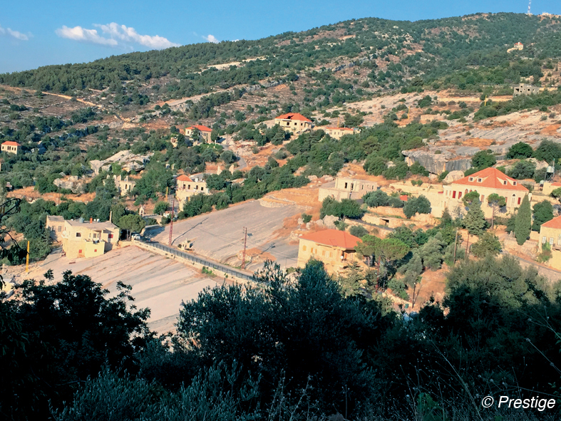
«Douma the health, Douma the iron». That’s how this village of Batroun heights was called, perched at 1000m along the Kfar Hilda Valley. And for good reason. Renowned for its ideal climate, its rich and fertile land with olive trees, vineyards and apple trees, Douma was also nicknamed «Douma el Hadid» in allusion to the rich iron ore deposits in the land that allowed them to produce weapons, swords and guns, contributing for a long time to the prosperity. Located on the road connecting the Syrian interior to the coast, the village occupied for centuries a central place where Greeks, Romans and Ottomans passed. Douma which means house or castle, takes its name from that of an Oriental Empress, Julia Duma, wife of the Roman emperor Septimius Severus, 193-211, who built her a palace in the village. With an Old Souk, 240 houses classified national heritage, a water source Ain el Tahta bearing Greek inscriptions, rocky places with Latin inscriptions, sarcophagus for Castor Minister of Worship of Health gods dating from the IVth century BC. Vaults of the central square and churches with the names of families of their builders … Douma is the destination well worth visiting. In his book «History of Douma», Father Costantine Bacha of the Congregation of Saint-Sauveur, tells in an interesting way the history of the village since Roman times.
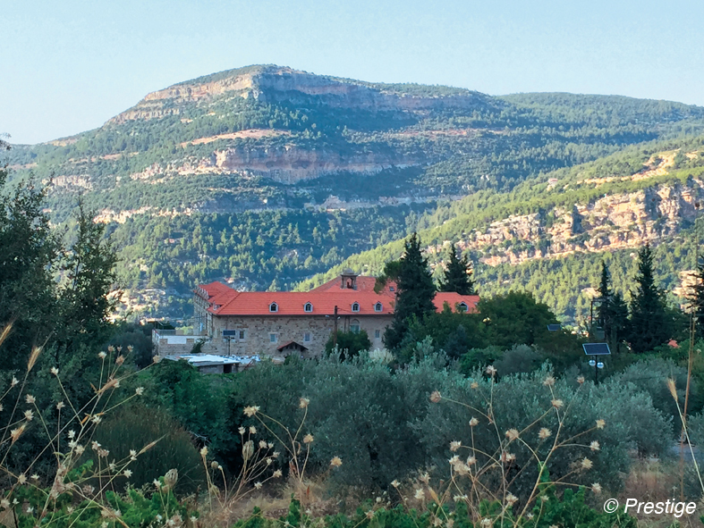
Mar Yuhanna Monastery in Douma
The Kaza of Batroun is very rich in Built Religious Heritage, including the Mar Yuhanna Monastery for the Greek Orthodox and its hermitage dating from the Crusader period. Like the monasteries of the region, it was built in the Vth century on the ruins of a pagan temple from the second century. The bases are made of huge blocks of stone that had been given at the time by the Romans for the construction of temples. On the walls of the old convent church, built at the same time, there are frescoes dating from the XIth century. For years, the monastery was abandoned before being restored for the first time in the XVIIIth century by the monks of the monastery of Chouaiya in the Metn, and again in the early XIXth century. Collapsed in 1956, the tower was restored around 1967 and during the Lebanese war, the monastery was abandoned and turned into barracks. In 1990, the new Orthodox monastic community of the Holy Trinity moved there. Since then, a dozen nuns live there in prayer, contemplation and work the land.
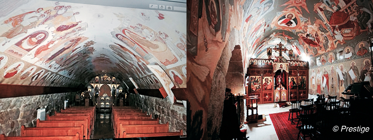
- The Church of the Holy Trinity was originally a cellar. Its walls are covered with superb frescoes, executed in 1999-2000 by the Romanian iconographer Castel Micu.
- The Church of the Nativity of St. John the Baptist, built in the Vth century. Its frescoes date from the XIth century. Until the XXth century, it has undergone numerous restorations, The last one done by Costel Micu.
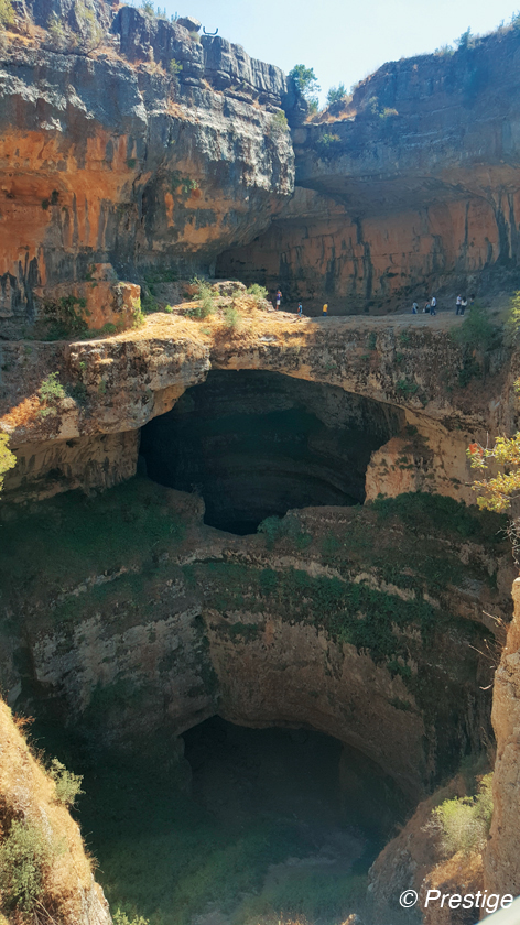
Baloue Balaa or Baatara abyss,
The three Bridges abyss
Five minutes from the village of Balaa, on the road between Laklouk and Tannourine the abyss of Baatara or three Bridges abyss is a wonder of nature. 250m deep and 260m wide, widened during the Jurassic era in the upper limestone layers, it has two formations shaped as bridges, one third of the depth from the surface, the other two thirds. From the opposite bank of the abyss, both layers give the impression with the top to form three bridges. When the snow melts in spring, the Baatara gulf forms a waterfall 90m high which fall behind the three bridges. In 1988, an exploration to the fluorescent dye “Dye” showed that the water disappeared in the Gulf to reappear in the spring at the source of Dalleh in the al-Ghaouaghir Mgharet cave at Kfar Hilda, Bsetine al Assi. The gulf was discovered in 1952 by the French caver Henri Coiffait, while the waterfall and accompanying sinkhole’s have been mapped by the caving club of Lebanon in 1980.
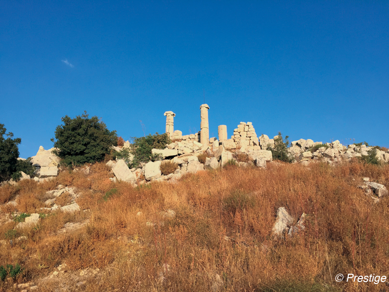
Hardine and the Temple of god Mercury
Located 1100m above sea level, the village of Hardine, meaning «pious» in Syriac, offers breathtaking views of the three cazas of Batroun, Koura and Bécharré to the sea, off the Syrian coast. Decorated with a glorious past, it is renowned for its historical caverns, vast forests, marine fossils embedded in the rock and attributed to ancient geological eras, its mid-hermitages built in the rock, thirty churches decorated with ancient frescoes, monasteries carved into the walls of the mountain and its Phoenician and Roman tombs. A peculiarity of the region, the huge slab or «blata» an escarpment inclined to the west of single dimension along 350m 100m wide, which runs gently down between the houses. Dominating all access to the Bekaa and the North region, the Temple of Mercury, dedicated to the god of travelers and trade, is an enchanting beauty. Nicknamed « The Roman Palace of Hardine», it is one of the largest and oldest Roman temples in the area dating back to the time of Emperor Hadrian Augustus, 117-137. From the temple one can enjoy an impressive 360˚ view, you can even see the Syrian coast. Hardine is the birthplace of St. Nehmatallah el Hardini whose house has been turned into ethnic museum, and Sarah, the first Lebanese woman hermit, 1199, is the daughter of Hardine. Before its transfer to Wadi Qannoubine, the seat of the Maronite Patriarchate was in Hardine.